Nam Ton Watershed
Knowledge Platform
Home
Context
Socio-Economic Context
Population Profile
Infrastructures
Education
Administrative Boundaries
Interactive Webmap
Land Water Use
PWLUP concept
PWLUP Methodology
Demography & Socio-economy
Rice Production & Livestock
Villages Land Tenure
Land Use
PWLUP Outputs
Water Use
Water use sectors
Domestic Water Use
Irrigation
Natural Resources
Water Quantity
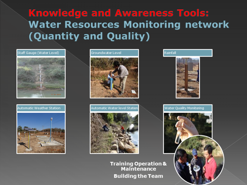
The Nam Ton Hydro-Meteorological Network
Staff Gauges
Rain Gauges
Automatic Water Level Stations
Automatic Climate Station
Groundwater Monitoring
Flow Measurement
Data Base Development & Modelling perspective
Water Quality
Surface Water Quality Monitoring
Ground Water Quality Monitoring
Sediment Quality Monitoring
Analysis & Recommendations
Geology
Forests
Aquatic Resources
Field Survey
Nam Ton mainstream and its tributaries
Permanent and perennial water bodies
Seasonal water bodies (village back-swamps)
Small water bodies
Rain-fed and irrigated lowland rice
Sedimentology
Wildlife & Conservation Areas
SUMALOM
SUMALOM Methodology
GIS
Tools
Watershed Guidelines
Watershed Kit
About Basin and Watershed Knowledge...
For Kids
You are here:
Home
SUMALOM
SUMALOM Methodology
SUMALOM Methodology
Email
Joomla template
created with Artisteer.
Images by Flickr/preetamrai
 SUMALOM SUMALOM Methodology